|
|
24 Aerial photos from Botswana
from: Caprivi | Chobe | Kalahari | Okavango Delta |

|
|
|
|
|
|
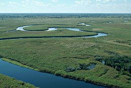
The Okavango River in the panhandle reaches its highwater in March. Then the water needs more than 3 month to reach Maun.
|
|
Picture taken 21.5.2008 -
aerial photo #0017-0068
|
|
|

|
|
|
|
|
|
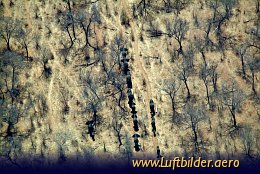
Elephants in the Chobe National Park on their way to the river. Most of the Botswana Elephant population lives around the Chobe River.
|
|
Picture taken 19.8.2007 -
aerial photo #0013-0488
|
|
|

|
|
|
|
|
|
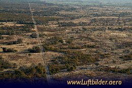
The buffalo fence is 3000km long and was erected in 1954 to segregate wild buffalo herds from domestic free-range cattle. It was built to prevent the spread of foot and mouth desease. The problem is that the fence prevents wild animals from migrating to water sources along age-old seasonal routes. As a result Botswanas wildebeest population declined by 99% over the past decade and all buffalo and zebra are stranded north of the fence.
|
|
Picture taken 24.8.2007 -
aerial photo #0014-0635
|
|
|
|