|
|
10 Aerial photos from Sambia
from: Victoria Falls |

|
|
|
|
|
|
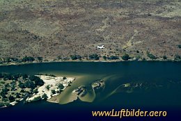
The Sambesi River has its source in Sambia and ends after 2574 kilometres in the Indian Ocean. It forms the natural border between Sambia and Nambia and between Sambia and Simbabwe. Near Livingstone (Sambia) and Victoria Falls (Simbabwe) it falls down over 110 m. There is Africas most spectacular water fall - the Victoria Falls.
|
|
Picture taken 19.8.2007 -
aerial photo #0013-0263
|
|
|

|
|
|
|
|
|
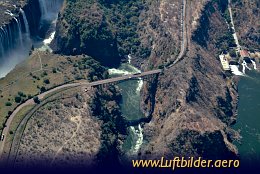
From the Victoria Falls Bridge, with the thundering falls in the back, adventureous bungee jumpers quaff off 111m towards the Zambesi River.
|
|
Picture taken 19.8.2007 -
aerial photo #0013-0328
|
|
|

|
|
|
|
|
|
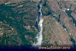
Mosia-oa-Tunya - the smoke that thunders - call the native inhabitants the Victoria Falls. The dispersed waterfog can already be seen from the distance above the plans of the Zambesi River. The southern sun creates colourful and spectacular rainbows.
|
|
Picture taken 19.8.2007 -
aerial photo #0013-0438
|
|
|
|