|
|
11 Aerial photos from Cyclades:
from: Delos | Insel Aegina | Insel Ikaria | Insel Naxos | Insel Paros | Insel Santorin | Insel Syros |

|
|
|
|
|
|
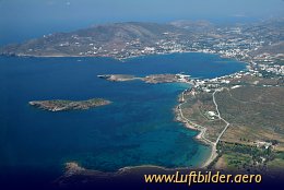
The Cycladic Island of Syros is located 78 nm South-East of Athens. In Byzantine times it became part of the Aegean Empire. Later is was ruled by the Venetians. Notwithstanding their changing rulers the inhabitants of Syros never gave up their Greek language.
|
|
Picture taken 29.4.2006 -
aerial photo #0007-0447
|
|
|

|
|
|
|
|
|
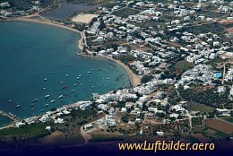
Yacht haven on Paros. Paros is called Heart of the
Aegean because of its central location.
|
|
Picture taken 27.4.2006 -
aerial photo #0007-0305
|
|
|

|
|
|
|
|
|
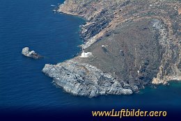
Ikaria is populated since 7000 b.C. In the 6th century b.C. it belonged to the kingdom of
Polykrates. Later it was adminstered by the crusaders, conquered by the Turks and became a
free state in 1912. A small island with an eventful history.
|
|
Picture taken 29.4.2006 -
aerial photo #0007-0443
|
|
|
|