|
|
493 Aerial photos

|
|
|
|
|
|
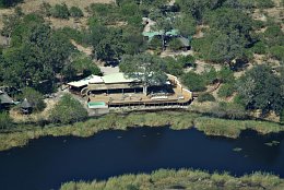
The Kings Pool Camp is located in the Linyanti game reserve, a private reserve in the North of Botswana.
|
|
Picture taken 22.5.2008 -
aerial photo #0017-0153
|
|
|

|
|
|
|
|
|
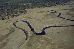
Here is where the Linyati River, which is called Kwando in Angola and Chobe River later, ends. Later in the year, when the floods from Angola have reached the Caprivi strip it will merge with the Zambesi River and fall down the Victoria Falls.
|
|
Picture taken 22.5.2008 -
aerial photo #0017-0184
|
|
|

|
|
|
|
|
|
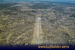
The Chobe Airstrip, with the runways 12/30 is 1000m long and 18m wide. Its operated by the Okavango Wilderness Safaris. In order to land there prior permissions is required. The strip can easily be found. The route passes over Hippo pools in the Khwai/Xakanaka flood plains.
|
|
Picture taken 20.8.2007 -
aerial photo #0013-0604
|
|
|
|